Western Okataina Walkway
|
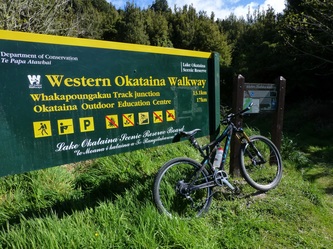
In September 2012 the Department of Conservation and the Lake Okataina Scenic Reserves Board officially opened the Western Okataina Walkway to dual usage (Both walking and mountain biking).
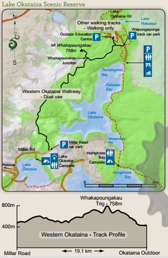
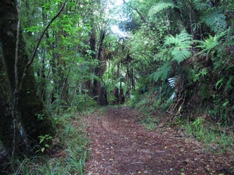
The Western Okataina Walkway is an old logging road that dates back to earlier last century when the area was logged for rimu, totara, rata & kahikatea. It is generally wide and well formed. From Millar Road it is mostly an undulating 11.5 km, with a solid climb towards the Whakapoungakau junction. From the junction it is a short detour of 1.4 km up to the trig where views of the surrounding area, Lakes Rotorua & Rotoiti abound. The next 4.8 km are mainly downhill to the Outdoor Education Centre or to Waipungapunga car park. It is a part of efforts by DOC to provide more recreational opportunities, increasing the amount of users on existing trails and working with the wider community in growing the region. The walkway has taken a bit of a pounding from livestock and motorbikes. By introducing mountain bikers into the mix, DOC hopes to push out these non-legit users. Local mountain bikers are also lined up to apply some tender loving care to the trail. WOW will be dual use and two-way – like W2K on Lake Taupo. However, it is an old forestry track with wide benching for passing and with good sight lines. Riders will still need to be cautious – and courteous. That’s the detail – more important, how will the WOW ride? The track will be opened from three entry points (two on Okataina Road - the Okataina Education Camp and Waipungapunga car park) then at Millar Road, Lake Okareka, with a total ride of about 16.5 kilometres, one way. Simon Alefosio-Tuck from DOC has ridden the walkway in both directions. He reckons Millar Road to the Education camp is the best direction for a one-way ride, starting with 11.5 kilometres to the Whakapongakau Trig track junction. This is mostly undulating with a solid uphill nearing the junction. From there it’s an exciting 4.8 kilometres downhill all the way to end. “It’s a great endurance/back country track just 15mins from Rotorua city” says Simon. “Mainly grade 3, but the climbs are solid in length and gradient. Expect to find a couple of un-ride able sections (stream crossings and rutted trails) unless you’re a skilled rider” Some of the downhills, especially the last 500 metres into the Education Camp, are a bit steeper. These have large drainage features, so maybe a Grade 4, in places.” A challenging ride that has proved popular in the past is from Millar Road to The Clearing and back (18 kilometres). “The Clearing is an old skid site that is an open grass field,” says Simon. “It’s similar to the clearing on Tuhoto Ariki, just ten times bigger.” There will be signage at all the entry points explaining the trail conditions and a map to show the area concerned. The Lake Okataina Scenic Reserve Board approved the opening of WOW to mountain biking for a two-year trial period. “There will be regular monitoring of the track by DOC and the Reserve Board for wear and tear, conflict with other users and illegal track building. But hopefully we’ll just see more people out there having fun.” says Simon. The Disclaimer: This track differs considerably to the majority of the trails in the Whakarewarewa Forest. It isn’t in pine forest, the trail hasn’t been carefully constructed and maintenance doesn’t include a fined toothed comb. It is mainly in native bush, drains water slowly, can stay boggy in places for weeks, has large ruts that virtually never get any attention, the vege/gorse gets trimmed once a year (but only if we have to) and there is no coffee carts on the track at all. However, if you are up for adventure, enjoy a challenge and the satisfaction that comes with ‘knocking the bastard off’ (quote thanks to Ed Hillary) then this track is for you. |

